FORGING A VIRTUAL LINK
WITH THE PAST:
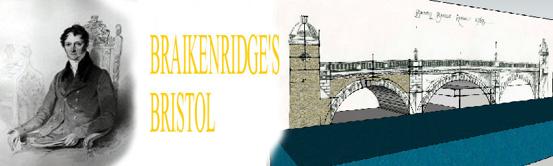
BRISTOL - 1825
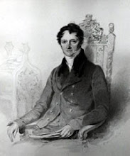
Follow my blog as I take you back 200 years and use GOOGLE SKETCHUP & TWILIGHT RENDER to virtually rebuild that lost Venice of the West; the best, oldest visually documented city in Britain, thanks to the collection of George Weare Braikenridge and others, with over 1400 drawings and paintings of a time a generation before photography.
The above documentation will revive the City of the 1820's using map overlay regression and Google Sketchup 3D modelling programme, complimented by Twilight Render adding real sun, shadow and material reflection. Dive in to a virtual world of tall ships, merchants and horse sleds; walk the city streets and climb the hills and church towers; go anywhere in real 365 day sun and shadow and compare scenes with the exact modern photograph of today, to the nearest foot.
First we must set the scene............
Between 630pm and 11pm on Sunday 24th November 1940, 135 German bombers laid waste to the medieval heart of Bristol which had developed over 1000 years (My Grandads's GPO trailer parked on Back of Bridge St, just off Bristol Bridge was blown into the floating harbour) The bustling core that had sprung up in place of the massive Norman Castle, along with large swathes of Broadmead and Redcliffe were left in smouldering ruins. What remained was largely and ruthlessly swept away by the city planners who continue today, to pay maximum homage to the infernal internal combustion engine.
The burnt out shells of St Mary Le Port and St Peters are all that remain of the core of a shopping area that was once second only in rateable value to Oxford Street, London.
Below: photomatch trials underway; Granger's Cooperage (Formerly Robert Adams' house) in Castle Mill Street backed onto the bank of the river Frome, the river being some 30 feet below this street, with 16th Century merchants shop and living quarters on the front. To the left, the Newgate Prison and city wall bastion had recently been demolished. The Georgian house in shadow, right was built on the infilled deep dry western edge (Fosse) of the Castle Moat. Today, the middle of the warehouse model shown here would be right in the entrance to the galleries car park; the 2 ladies in the painting standing on the b.u. of "bus lane", painted in the road next to the yellow warning box.


So, imagine if you will and come back with me. First we must remove every modern building, gleefully tearing away the faceless concrete and glass jungle leaving the City Churches, Glass cones, Sugar Houses and chimneys towering over the merchant’s houses and shops. Every car, lorry and bus must go, even the trams were not around. There is no electricity and gas lighting in the streets has not long begun. All tarmac must go; most roads are just dirt, with the main important streets only being cobbled in stone sets and central or side open gutters.
We must rip open the quarter mile city centre and uncover Rupert Street and Fairfax Street, all the way to Wade Steet, revealing the stinking, meandering river Frome 10 feet below along with its moat around 2 sides of the Castle Precincts. We replace the city centre traffic and empty Welsh Back and Redcliffe quays with 250 sailing ships up to 600 tons each, plying trade between the Caribbean, Canada and coastal Britain. There is no Suspension Bridge and No Colston Hall. There is no Cabot tower and Brunel is still in London helping his Father, so no railways yet and no aircraft for sure! The city only exists as 2 square miles centred on Bristol Bridge, with the population of modern Bath; The little village of Clifton and a few cottages are scattered amongst the surrounding fields of the now built up 80 square mile conurbation.
The only “modern” thing is the new cut (which most Bristolian’s would not realise is man made!) and the floating harbour; up until only a decade before the river level at Bristol Bridge would drop 26 feet, twice every 24 hours and the 200 tall ships would roll all ways on the mud banks in a frenzied tangle of masts and rigging! The Frome up St Augustine's reach, would also empty right out to a trickle, right back to the weir in Lewin's Mead.
below: preliminary contour mapping at the 5m interval; Bristol view north-east; the island is Queens Square between the large yellow mounds of the old city left and Redcliffe, right
 This then is Britain’s second City port to London, a City of Tall Ships between rows of Tudor jettied houses, many recently rebuilt or refronted in Georgian Facades. Using the Reece Winstone archive, surviving buildings, archaeology and paintings and drawings of the Bristol School of Artists, this sets the scene of the Bristol of the 1820's;
Welcome back to Braikenridge's Bristol!
WITH THE PAST:
BRISTOL - 1825
Follow my blog as I take you back 200 years and use GOOGLE SKETCHUP & TWILIGHT RENDER to virtually rebuild that lost Venice of the West; the best, oldest visually documented city in Britain, thanks to the collection of George Weare Braikenridge and others, with over 1400 drawings and paintings of a time a generation before photography.
The above documentation will revive the City of the 1820's using map overlay regression and Google Sketchup 3D modelling programme, complimented by Twilight Render adding real sun, shadow and material reflection. Dive in to a virtual world of tall ships, merchants and horse sleds; walk the city streets and climb the hills and church towers; go anywhere in real 365 day sun and shadow and compare scenes with the exact modern photograph of today, to the nearest foot.
First we must set the scene............
Between 630pm and 11pm on Sunday 24th November 1940, 135 German bombers laid waste to the medieval heart of Bristol which had developed over 1000 years (My Grandads's GPO trailer parked on Back of Bridge St, just off Bristol Bridge was blown into the floating harbour) The bustling core that had sprung up in place of the massive Norman Castle, along with large swathes of Broadmead and Redcliffe were left in smouldering ruins. What remained was largely and ruthlessly swept away by the city planners who continue today, to pay maximum homage to the infernal internal combustion engine.
The burnt out shells of St Mary Le Port and St Peters are all that remain of the core of a shopping area that was once second only in rateable value to Oxford Street, London.
Below: photomatch trials underway; Granger's Cooperage (Formerly Robert Adams' house) in Castle Mill Street backed onto the bank of the river Frome, the river being some 30 feet below this street, with 16th Century merchants shop and living quarters on the front. To the left, the Newgate Prison and city wall bastion had recently been demolished. The Georgian house in shadow, right was built on the infilled deep dry western edge (Fosse) of the Castle Moat. Today, the middle of the warehouse model shown here would be right in the entrance to the galleries car park; the 2 ladies in the painting standing on the b.u. of "bus lane", painted in the road next to the yellow warning box.


So, imagine if you will and come back with me. First we must remove every modern building, gleefully tearing away the faceless concrete and glass jungle leaving the City Churches, Glass cones, Sugar Houses and chimneys towering over the merchant’s houses and shops. Every car, lorry and bus must go, even the trams were not around. There is no electricity and gas lighting in the streets has not long begun. All tarmac must go; most roads are just dirt, with the main important streets only being cobbled in stone sets and central or side open gutters.
We must rip open the quarter mile city centre and uncover Rupert Street and Fairfax Street, all the way to Wade Steet, revealing the stinking, meandering river Frome 10 feet below along with its moat around 2 sides of the Castle Precincts. We replace the city centre traffic and empty Welsh Back and Redcliffe quays with 250 sailing ships up to 600 tons each, plying trade between the Caribbean, Canada and coastal Britain. There is no Suspension Bridge and No Colston Hall. There is no Cabot tower and Brunel is still in London helping his Father, so no railways yet and no aircraft for sure! The city only exists as 2 square miles centred on Bristol Bridge, with the population of modern Bath; The little village of Clifton and a few cottages are scattered amongst the surrounding fields of the now built up 80 square mile conurbation.
The only “modern” thing is the new cut (which most Bristolian’s would not realise is man made!) and the floating harbour; up until only a decade before the river level at Bristol Bridge would drop 26 feet, twice every 24 hours and the 200 tall ships would roll all ways on the mud banks in a frenzied tangle of masts and rigging! The Frome up St Augustine's reach, would also empty right out to a trickle, right back to the weir in Lewin's Mead.
below: preliminary contour mapping at the 5m interval; Bristol view north-east; the island is Queens Square between the large yellow mounds of the old city left and Redcliffe, right

Welcome back to Braikenridge's Bristol!